Geologic Hazards Mapping : Mono Basin, 2006

Course Objectives

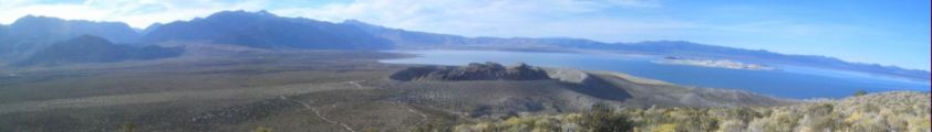
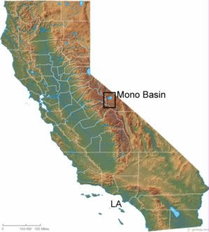
For two weeks in September, 2006, a two nation class led by professors Kerry Sieh and Yue-Gau Chen conducted geologic mapping of Quaternary geomorphic and volcanic relation area in west and south Mono Basin . The class consisted of 10 students and teaching assistants, each 5 from Caltech and National Taiwan University . The purposes of this course are:

(1) To map and interpret structures such as moraines, faults, deltas, shorelines and the rise and fall of the lake; to map and interpret structures of volcanoes such as tephra, pyroclastic flows and domes.

(2) To promote cultural enrichment through international collaboration.

Mono Basin

On the west and south side of mono lake, marked by black frames, was the area we went for field work.

Mono lake is in one of the basins of the Great Basin between Sierra Nevada and the CA/NV/AZ border. The Great Basin is one of the four great deserts in North America , which has the highest elevation of all four. Fifteen thousand years ago this area is almost filled with water, but as the weather changed, most of the lakes dried up. In recently geologic time, the Mono Craters erupted. The last eruption, Panum Crater, occurred less than 700 years.
|Top | ©2006 Yvonne Liu